 |


It should be noted that many existing HDF and HDF-EOS tools could be problematic when used on the Joint Atmosphere Product due to two non-standard EOS HDF file characteristics:
- the geolocation arrays are stored in packed integer format, instead of the traditional float or real format (done to save space)
- there are multiple geolocation arrays, due to multiple resolution data being stored (5-km geolocation is default and has standard geolocation SDS names, 10-km geolocation has non-standard geolocation SDS names)
All versions of HDFLook, in standalone mode, allow one to look at any 5-km or 10-km SDS, unprojected.
This is accomplished by launching the program in interactive mode and then selecting the HDF file and dataset (SDS).
Creating projected images (that require geolocation) is only possible in HDFLook v3.5 and later
since it was modified to handle (non-standard) packed integer geolocation arrays.
However, this version of HDFLook was NOT modified to support geolocation arrays stored using non-standard SDS names,
as was done for the 10-km geolocation.
For 5-km arrays, HDFLook (v3.5 or later) can be used as is, since the 5-km geolocation uses standard geolocation SDS names: 'Latitude' and 'Longitude'.
For 10-km arrays, the workaround is to use HDFLook with a pre-processing HDFLook script that extracts all the
10-km SDS arrays to a new (temporary) HDF file.
The 'Latitude_10km' and 'Longitude_10km' arrays are renamed to standard default SDS names ('Latitude' and 'Longitude')
so that HDFLook can then identify them properly.
This can be accomplished in a single step by installing HDFLook and then runing the script (both downloadable below).
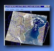
HDFLook
|
 A basic processing and visualization tool for MODIS HDF data within X-Window computer environments,
HDFLook can visualize structures of an HDF file including: scientific data sets (SDS), vector arrays (Vdatas and Vgroups), and
raster images (24 bits or 8 bits with a look-up table). HDFLook can visualize slices of data (up to 6 indexes), display global and local attributes, and automatically detect fill values.
HDFLook can also extract SDS ancillary data, export (raw or calibrated) SDS records to binary or HDF files, build reprojected SDS or RGB mosaics,
export RGB images to JPEG or HDF files, and print RGB images.
For programmers who routinely want jpgs or binary files, HDFLook can be run non-interactively with simple command files to routinely make images or export binary files from hdf
(see HDFLook: How To Examples).
For a more powerful tool, users should consider Msphinx (see below) which incorporates HDFLook as its HDF-EOS reader interface.
It should be noted that HDFLook and Msphinx are the only known graphical user interface tools that can (correctly and fully) read and visualize the new L2 Joint Atmosphere product.


|
Cost: Free
Current Version: 4.1
Release Date: January 2004
Requirements: Platform & operating system specific
Rating:


Development Team:
 Laboratoire d'Optique Atmosphérique / U. Lille Laboratoire d'Optique Atmosphérique / U. Lille
 University of Maryland / MODLAND GSFC-923 University of Maryland / MODLAND GSFC-923
 Distributed Active Archive Center (DAAC) / GSFC-902 Distributed Active Archive Center (DAAC) / GSFC-902
Compatibility:

|
Macintosh
 OS-X 10.3 Panther OS-X 10.3 Panther
 OS-X 10.2 Jaguar OS-X 10.2 Jaguar
|

|
Linux
 Power PC Power PC
 Intel Intel
 Cygwin Cygwin
|

|
Unix
 SUN - Solaris 5.7 SUN - Solaris 5.7
 SGI - IRIX 6.5 SGI - IRIX 6.5
 IBM - AIX 4.3.2 IBM - AIX 4.3.2
 HP - HP-UX 10.2 HP - HP-UX 10.2
 DEC - OSF/1 v4.0 DEC - OSF/1 v4.0
|

|
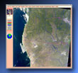
Msphinx
|
 A more powerful tool than HDFLook (outlined above), Msphinx incorporates HDFLook as its HDF reader interface.
Msphinx (Motif Satellite Process Handling Images uNder Xwindow) is a powerful image analysis, data plotting, and format conversion package.
Msphinx includes functions to process in the basic data geometry and projection planes, as well as functions to manipulate and modify the graphic display and printing.
Msphinx also includes page setting and poster setting (large size: Gigabyte PostScript files) printing capabilities.
Msphinx allows data writes from external user programs (C or Fortran) into the memory planes, background capabilities with command files, user to user data exchange (text or images), and direct links to other packages including: HDFLook (HDF file read/write), Mgraph (2D and contouring plotting), Xfig (Facility for Interactive Generation of figures), and Mpeg_Encode (mpeg format animations).
It should be noted that Msphinx and HDFLook are the only known graphical user interface tools that can (correctly and fully) read and visualize the new L2 Joint Atmosphere product.


|
Cost: Free
Current Version: 9.4
Release Date: January 2004
Requirements: Platform & operating system specific
Rating:


Development Team:
 Laboratoire d'Optique Atmosphérique / U. Lille Laboratoire d'Optique Atmosphérique / U. Lille
Compatibility:

|
Macintosh
 OS-X 10.3 Panther OS-X 10.3 Panther
 OS-X 10.2 Jaguar OS-X 10.2 Jaguar
|

|
Linux
 Power PC Power PC
 Intel Intel
 Cygwin Cygwin
|

|
Unix
 SUN - Solaris 5.7 SUN - Solaris 5.7
 SGI - IRIX 6.5 SGI - IRIX 6.5
 IBM - AIX 4.3.2 IBM - AIX 4.3.2
 HP - HP-UX 10.2 HP - HP-UX 10.2
 DEC - OSF/1 v4.0 DEC - OSF/1 v4.0
|

|
10km Parameter Extraction Shell Script
|
The shell script is self-documented, simply more the script
more atml2hdflook10km.sh
or execute the command (without any parameters)
./atml2hdflook10km.sh
to view documentation details.

|
|
|