 |

Product Description
The MODIS Cloud Product combines infrared
and visible techniques to determine both physical
and radiative cloud properties. Daily global
Level 2 data are provided. Cloud-particle
phase (ice vs. water, clouds vs. snow), effective cloud-particle
radius, and cloud optical thickness are derived
using the MODIS visible and near-infrared
channel radiances. An indication of cloud shadows
affecting the scene is also provided. Cloud-top temperature,
height, effective emissivity, phase (ice vs.
water, opaque vs. non-opaque), and cloud fraction
are produced by the infrared retrieval methods both
day and night at 5x5 1-km-pixel resolution. Finally,
the MODIS Cloud Product includes the cirrus reflectance
in the visible at the 1-km-pixel resolution, which
is useful for removing cirrus scattering effects from
the land-surface reflectance product.
There are two MODIS Cloud data product files:
MOD06_L2, containing data collected from the Terra platform; and
MYD06_L2, containing data collected from the Aqua platform.
Research and Application
A thorough description of global cloudiness and its
associated properties is essential to the MODIS mission
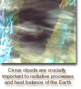
for two reasons. First, clouds play a critical role
in the radiative balance of the Earth and must be accurately
described in order to assess climate and potential
climate change accurately. In addition, the
presence or absence of cloudiness must be accurately
determined in order to retrieve properly many atmospheric
and surface parameters. For many of these
retrievals, cloud cover, even thin cirrus, represents
contamination. Key radiative properties of clouds
such as phase, optical thickness, and temperature may
be retrieved using MODIS instruments with unprecedented
resolution.
Data Set Evolution
The determination of cloud-top properties will require
the use of MODIS bands 29 and 31-36, along with
the cloud-mask product (MOD35), to screen for
clouds. In addition, NCEP or DAO global model
analyses of surface temperature and pressure, profiles
of temperature and moisture, and blended SST
analyses will be required in the calculation of cloud
forcing as a function of atmospheric pressure and
emissivity. The Menzel cloud-phase algorithm will
require MODIS bands 29, 31, and 32 and analyses of
surface emissivity.
The validation of cloud-top heights will be conducted
through comparisons with stereo determinations
of cloud heights from GOES and lidar estimates
and aircraft observations of cirrus heights. Cloud
emissivity will be compared to lidar-determined values.
These interim products will be used in concert
with field campaigns with the MAS instrument. The
Menzel cloud-phase parameter will be validated using
HIRS/AVHRR data and by comparison to the
King cloud-phase parameter.
The King cloud-phase algorithm requires product
MOD 02, calibrated multispectral radiances. Cloud-particle
size and optical thickness require these radiances
plus the cloud-top parameters within MOD06
and the Menzel cloud-phase parameter. In addition,
these parameters require MODIS product MOD43
(surface reflectance) and the NCEP or DAO analyses
and profiles described above. The validation and
quality control of these products will be performed
primarily through the use of in situ measurements
obtained during field campaigns and with the use of
the MAS instrument.
Additional Information
Coverage: Global
Spatial/Temporal Characteristics: Resolutions of
1 km or 5 km/once or twice per day (varies
with parameter)
Key Science Applications: Cloud parameteriza-tion,
climate modeling, climate monitoring,
increasing accuracy of other MODIS
retrievals
Key Geophysical Parameters: Cloud-particle
phase (two algorithms), cloud-particle size
and optical thickness, cirrus reflectance at
1.375 µm, and cloud-top temperature,
emissivity, and height
Processing Level: 2
Product Type: Standard, at-launch
Maximum File Size: 65 MB
File Frequency: 288/day
Primary Data Format: HDF-EOS
|