

Product Description

The MODIS Atmospheric Profile product
consists of several parameters: they are total-ozone
burden, atmospheric stability, temperature and moisture
profiles, and atmospheric water vapor. All of
these parameters are produced day and night for Level 2
at 5x5 1-km pixel resolution when at least 9 FOVs are cloud free.
There are two MODIS Atmosphere Profile data product files:
MOD07_L2, containing data collected from the Terra platform; and
MYD07_L2, containing data collected from the Aqua platform.
The MODIS total-ozone burden is an estimate of the total-column
tropospheric and stratospheric ozone content. The MODIS atmospheric
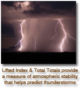
stability consists of three daily Level 2 atmospheric stability indices.
The Total Totals (TT), the Lifted Index (LI), and the K index (K) are
each computed using the infrared temperature- and moisture-profile data,
also derived as part of MOD07. The MODIS temperature and moisture
profiles are produced at 20 vertical levels. A clear sky synthetic
regression retrieval algorithm is used, where regression coefficients
are derived by using a fast radiative transfer model with atmospheric
characteristics taken from a dataset of global (radiosonde and model)
profiles. The MODIS atmospheric water-vapor product is an estimate of
the total column water vapor made from integrated MODIS infrared
retrievals of atmospheric moisture profiles in clear scenes.
Research and Application
Total-column ozone estimates at MODIS resolution
are required by MODIS investigators developing atmospheric
correction algorithms. This information
is crucial for accurate land and ocean-surface-parameter
retrievals. Furthermore, strong correlations have
been found to exist between the meridional gradient
of total ozone and the wind velocity at tropopause
levels, providing the potential to predict the position
and intensity of jet streams. Total-column ozone
monitoring is also important due to the potential harm
to the environment caused by anthropogenic depletion
of ozone.
Atmospheric instability measurements are predictors
of convective-cloud formation and precipitation.
The MODIS instrument offers an opportunity to characterize
gradients of atmospheric stability at high
resolution and greater coverage. Radiosonde-derived
stability indices are limited by the coarse spacing of
the point-source data, too large to pinpoint local regions
of probable convection.
Atmospheric temperature and moisture sounding
data at high spatial resolution from MODIS and high
spectral resolution sounding data from AIRS will provide
a wealth of new information on atmospheric
structure in clear skies. The profiles will be used to
correct for atmospheric effects for some of the MODIS
products (e.g., sea-surface and land-surface temperatures,
ocean aerosol properties, water-leaving radiances,
and PAR) as well as to characterize the
atmosphere for global greenhouse studies.
Total-column precipitable-water estimates at MODIS
resolution are required by MODIS investigators
developing atmospheric-correction algorithms. This
information is crucial for accurate land and ocean
surface-parameter retrievals. MODIS will also provide
finer horizontal-scale atmospheric water vapor
gradient estimates than are currently available from
the POES satellites.
Data Set Evolution
One of two ozone-retrieval methods developed using
the HIRS will be chosen as best suited for application
with MODIS data. Both use a first-guess perturbation
method and radiances from MODIS channel
30 (9.6 µm) to solve the radiative-transfer equation.
The perturbations are with respect to some a priori
conditions that may be estimated from climatology,
regression, or, more commonly, from an analysis or
forecast provided by a numerical model. The MODIS
cloud-mask product (MOD35_L2) will also be used
to screen for clouds.
Atmospheric-stability estimates will be derived
from the MODIS temperature and moisture retrievals
contained in this product. Layer temperature and
moisture values may be used to estimate the temperature
lapse rate of the lower troposphere and the
low-level moisture concentration.
Temperature and moisture profile retrieval algorithms are adapted from
the International TOVS Processing Package (ITPP), taking into account
the lack of stratospheric channels and far higher horizontal resolution
of MODIS. The profile retrieval algorithm requires calibrated,
navigated, and coregistered 1-km FOV radiances from MODIS channels 25,
27-29, and 30-36. The MODIS cloud mask (MOD35_L2) is used for cloud
screening. The algorithm also requires NCEP analysis of surface pressure.
Several algorithms for determining atmospheric water vapor, or
precipitable water, exist. It is most directly achieved by integrating
the moisture profile through the atmospheric column. Other,
split-window, methods also exist. This class of techniques uses the
difference in water-vapor absorption that exists between channel 31 (11 µm) and channel 32 (12 µm).
Data validation will be conducted by comparing results to in situ radiosonde, Microwave Radiometer and GPS
measurements, GOES sounder operational retrievals, NCEP analyses, and
retrievals from the AIRS/AMSU-A/HSB instrument package on the Aqua
platform. Quality control will consist of manual and automatic
inspections, with regional and global mean temperatures at 300, 500, and
700 hPa monitored weekly, along with 700 hPa dew-point temperatures and
atmospheric water vapor. For total ozone, data validation will consist
of comparing the TOMS retrievals to the MODIS retrievals.
Additional Information
Coverage: Global, clear-sky only
Spatial/Temporal Characteristics: 5 km
Key Science Applications:
- Ozone: atmospheric correction, predic-tion
of cyclogenesis, anthropogenic
ozone depletion
- Atmospheric stability: atmospheric
correction, prediction of convective
cloudiness and precipitation, characterization
of the atmosphere
- Soundings: atmospheric correction
algorithm development and use, characterization
of the atmosphere
- Total-column water vapor: atmospheric-correction
algorithm development and
use, characterization of the atmosphere
Key Geophysical Parameters: Total-column
ozone, atmospheric stability (Total Totals,
Lifted Index, and K index), atmospheric
profiles of temperature and moisture,
atmospheric total-column water vapor
Processing Level: 2
Product Type: Standard, at-launch
Maximum File Size: 28 MB
File Frequency: 288/day
Primary Data Format: HDF-EOS
|