

Product Grid
Level-2 Joint Atmosphere Product (ATM L2) parameters are produced at a spatial resolution of
either a 5x5 or 10x10 kilometer (at nadir) pixel array.
Each ATM L2 product file covers a five-minute time interval (based on
the start time of each MODIS Level-1B granule). This means that for 5km resolution
parameters the output grid is 270 pixels in width by 406 pixels in length
for approximately nine consecutive granules. Every (approximately) tenth granule has an output
grid size of 270 by 408 pixels. For 10km resolution parameters,
the output grid is 135 pixels in width by 203 pixels in length
for approximately nine consecutive granules. Every (approximately) tenth granule has an output
grid size of 135 by 204 pixels.
The granule size pattern is sporadic due to scanner inconsistency.
Finally, the spatial resolution of individual
parameters is detailed on the Format & Content page.
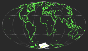
The image below depicts MODIS Level-2 granule coverage during a single simulated orbit.
It should be noted that a granule of Level-2 MODIS data is equal to a single Level-2 MODIS product HDF file.


|