MODIS Atmosphere
MODIS Atmosphere Home Products  Images  Validation  News  Staff  Forum  Reference  Tools  Help
Aerosol Product  Water Vapor Product  Cloud Product  Atmosphere Profile Product  Cloud Mask Product   Joint Atmosphere ProductLevel-2 Products
Daily Global Product  Eight-Day Global Product  Monthly Global ProductLevel-3 Products       Filled Land Surface Albedo ProductFilled Normalized Difference Vegetative Index ProductOne-Minute Land Ecosystem Classification ProductLevel-3 Ancillary Land Surface Products
One-Minute Land Ecosystem Classification Product
Introduction
Format & Content
Grids & Mapping
Viewing Browse Imagery
Downloading HDF Datafiles
Analysis Tools
Theoretical Basis
Detailed File Spec
Support Team

Grids and Mapping

Equal Angle Grid

The Ecosystem Product is stored on an equal angle lat-lon grid at 1-minute resolution.

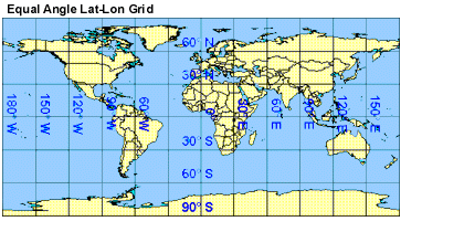
The upper left corner position of the first grid cell (1,1) is located at latitude 90°N and longitude 180°W. The convention used here is degrees north latitude are stored as positive numbers; while degrees west longitudes are stored as negative numbers. This allows lat/lon pairs to increase from top to bottom and left to right on the grid.

Next Page
BROWSE IMAGERY